‘More fish, less impact’: GPS technology helps skippers manage longline gear drift
GPS and satellite beacon technology provide an easy way for skippers to track their longline gear around Australian Marine Parks while improving fishing operations, a Tuna Australia research project has found.
“The GPS technology enables fishers to set their gear with greater confidence and support sustainable fishing,” said Tuna Australia CEO, David Ellis.
Funded through the Our Marine Parks Grants Program, the 18-month research project (July 2019-December 2020) trialled the use of GPS beacons and satellite data on longline tuna boats.
“This work would not have been possible without the Australian Government grant and it’s great that they are partnering with us on this innovation to protect marine life,” said Ellis.
Jason Mundy, Acting First Assistant Secretary, Parks Australia: “If fishers can understand how their gear is moving, they can actually catch more fish while also keeping their lines out of protected marine environments.”
How the system works
Australian tuna is typically caught on longline—a gear type consisting of a long fishing line with hooks attached via shorter branch lines. Reaching lengths of up to 50 nautical miles (92km), the longlines are set at sea and drift with the wind, current and tide.
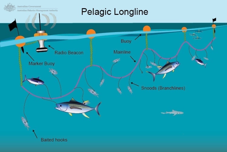
Longlining is not allowed in some Australian Marine Park management zones and fishers are required to anticipate the track of their longline to avoid accidental drift into these areas.
Currently, many skippers rely on current charts, radio beacons and their understanding of the ocean to estimate where their gear is going to end up.
“Your initial shot was the trouble shot,” said Tony Walker, skipper of the Sharp Shooter (part of the Walker Seafoods Australia fleet). “You would err on the side of caution, so you would want to be 20 or 30 nautical miles [37–55 km] away from the reef [sanctuary zone].”
As part of the Tuna Australia project, three different combinations of GPS / satellite beacons matched to different telemetry service were trialled on seven Tuna Australia member boats.
“GPS beacons are attached to the longlines and their positions map to a computer interface displaying information skippers deem important to their fishing operations,” explained Phil Ravanello, Program Manager, Tuna Australia.
“The beacons can be programmed to talk to the boat every couple of minutes and reveal their position in as near-to-real time as you can possibly get,” he said.
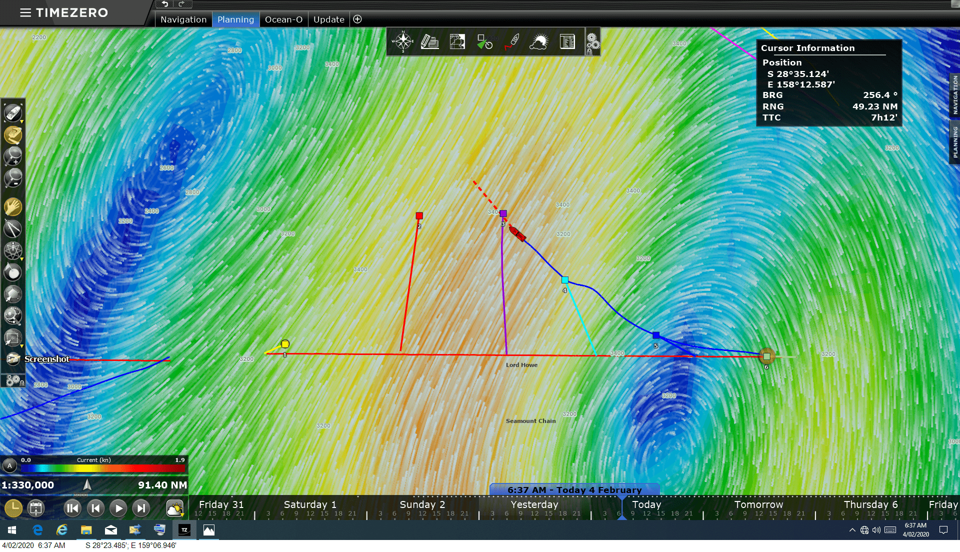
A screenshot of the system in action, showing sea surface temperatures among other vital data.
The telemetry services provide a suite of information, including water temperature, sea surface height anomalies, current speed and direction, salinity, chlorophyll, phytoplankton, thermocline and oxygen concentration and many more oceanographic data sets.
“I get everything at my fingertips,” said Walker, who trialled six GPS beacons with the TimeZero software for four months (November 2019–March 2020).
“I know right along my 50 nautical miles of line [92 km] where the temperature breaks are—it’s coming up on the screen.”
Feedback from skippers
The systems were trialled on each boat for three to four months at a time, drawing praise from most skippers.
Jason Boxsell, half owner and skipper of the Straight Shooter (part of the 4Seas fleet), described the GPS beacons as “very useful.”
For four months (December 2019–March 2020), Boxsell used the Marine View system by Marine Instruments. He had six GPS beacons spread across his 100 km (54 nautical miles) of line.
“Normally, we try to keep well away from marine parks. We can’t control our line, which can drift up to 50 nautical miles,” he said.
Now, because of the trial, I can see the benefits of having the GPS beacons around marine parks—so we can know exactly where our gear is as opposed to guessing where it is.”
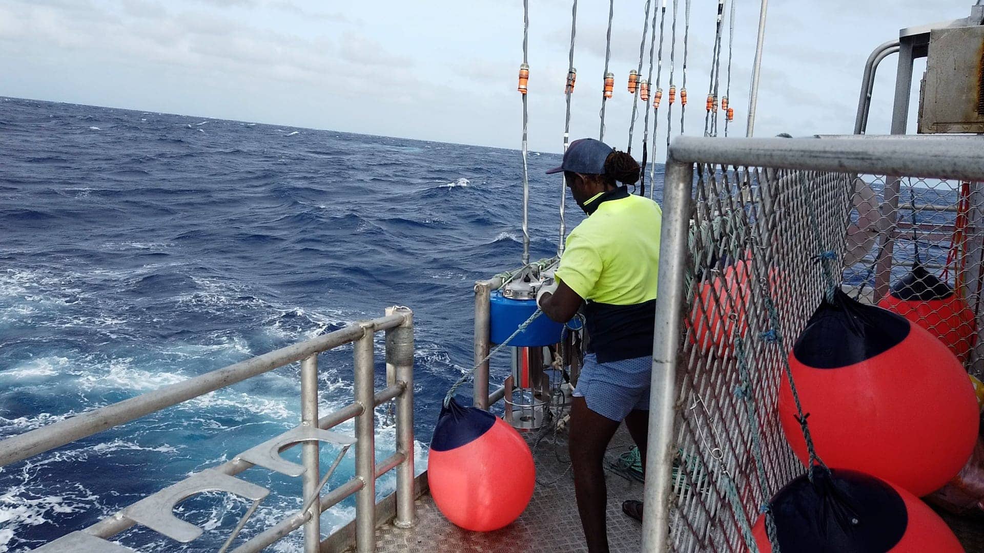
A worker preparing to deploy a buoy and GPS beacon.
Boxsell said this was his first-time using GPS beacons in his more than 20 years working on boats.
“I wish I had the [GPS] beacons on my boat all the time,” he said. “But if we had to pay it outright, it would be quite expensive to run.”
Beside managing longline drift, the GPS systems were found to provide other benefits not anticipated at the start of the project.
“The GPS system was good for fuel saving. I knew exactly where the line was if it broke,” said Boxsell. “In comparison, the radio buoys I’ve been using only give a guide of the longline distance and position, so you find yourself not going straight to it—you end up zig zagging a bit.”
Walker had similar feedback: “Now that we’ve got the GPS beacons and we can see the currents on our screen we can go straight to our shot, so we’re not wasting time, fuel and bait.”
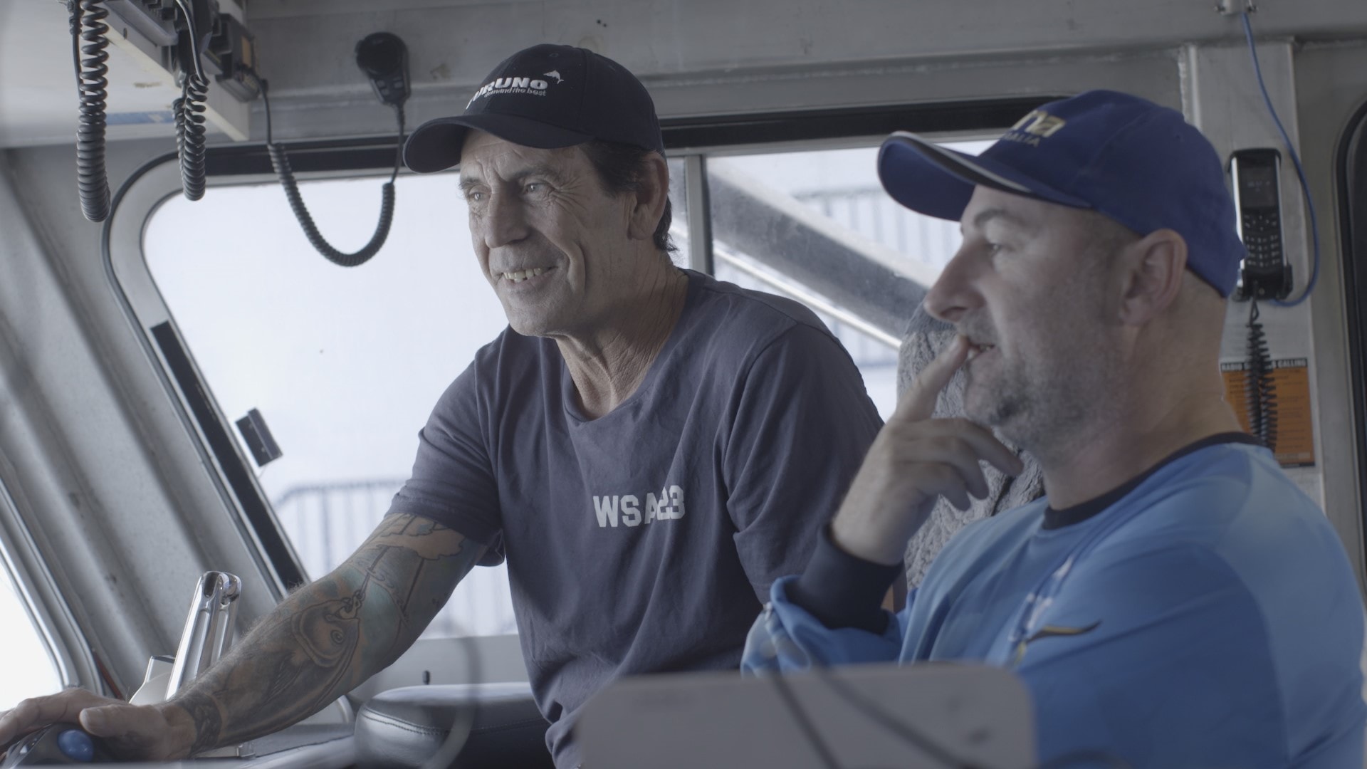
Skipper Tony Walker (L) with Tuna Australia Program Manager Phil Ravanello. Photo by Millstream Media.
For Shane Ralph, skipper of the Jordan Kate (part of the Angelica Fisheries fleet) in Ulladulla, his experience with the TimeZero software was mixed.
“Down this way [on the NSW south coast], the software wasn’t as accurate as what it has been proven to be further north.”
“I put that down to the ocean currents moving much faster down here than up north in the Coral Sea. It’s a bit of a disadvantage to us because the technology can’t keep up.”
Ralph said one positive of the system was the weather forecasts, which were “pretty accurate.”
Currently, Ralph uses five GPS beacons and five radio beacons, meaning he can “already see exactly where the gear is.”
Ralph said he is open to trying the software again in the future, but it would have to “get more accurate.”
“The currents are updated every 24 hours in the software. But because the currents are unpredictable from one day to the next, the software really needs to be updated every three to four hours.”